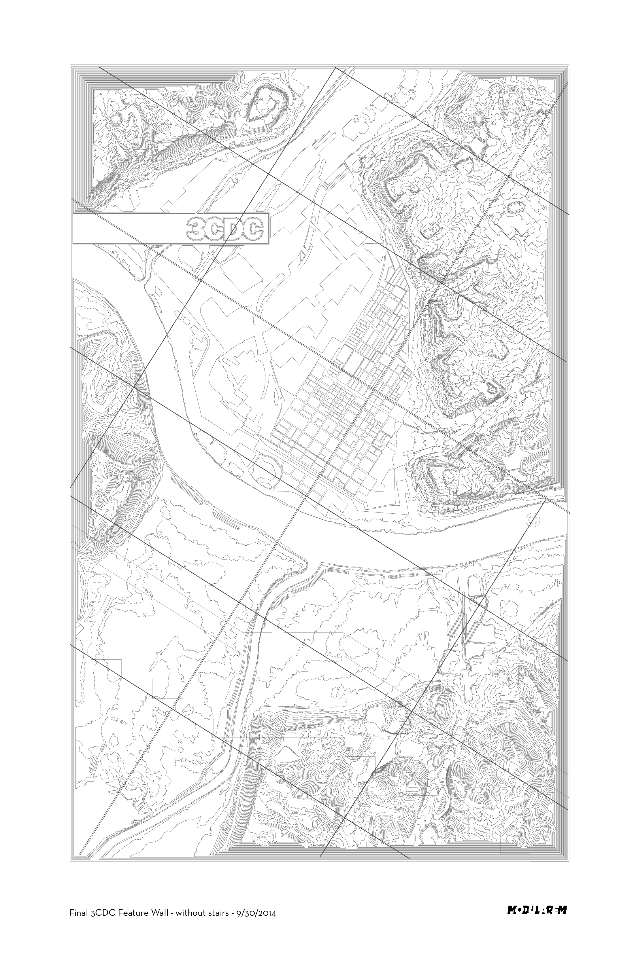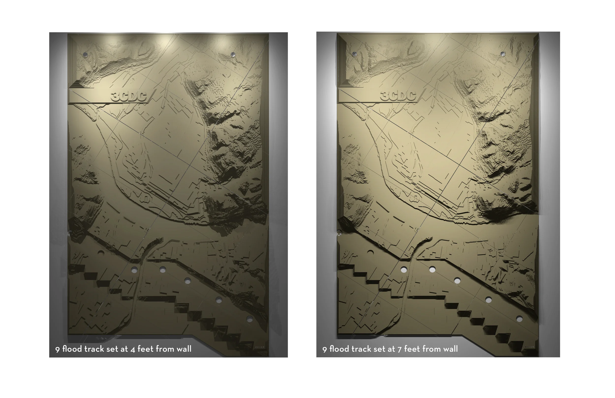

This permanent installation welcomes visitors to the headquarters of the non-profit, Cincinnati Center City Development Corporation, or 3cdc, which was formed in 2003 to partner with the City to revive its urban core. It is a two story topographical record of the the ohio river valley at Cincinnati, displayed at a specific moment in time. Similar to how the ceiling constellations of Grand Central Station record the exact celestial time of its completion, this wall records the land at the time 3CDC began to revive the city core. Its panels are organized on a grid whose origin marks the physical location of the company, skewed to the angle of the stairs that define the space. The topographical map is a well known information set to the architects, planners and developers that work there. I called it the Alluminnati, a combination of aluminum and Cincinnati, but also a reference to the unseen human interventions on the land revealed by the data.
I started the project by composing USGS digital topographical data into an aesthetic form. I then invented a structural system featuring thousands of tiny clips for assembly without welding or riveting. Using a CNC plasma cutter, all the pieces were cut from 60, 4’x8’ sheets of aluminum, a material chosen for its lightness and quality. My team and I then hand finished and assembled over 1200 pieces of aluminum into 22, 4’x6’ structural panels that were eventually tessellated into the final 2 story composition.
In all my work I try to dignify people through the spaces they inhabit and this piece offers a high level of detail and artistry, with the hope of giving those who experience it a memorable moment of wonder and delight.